


Sale!


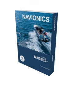

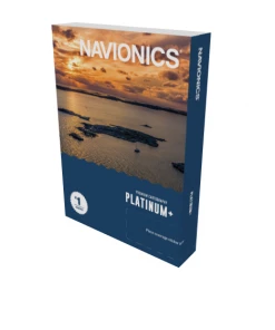
MARINE ELECTRONICS Navionics Navionics+ Map Card
Original price was: $144.81.$97.99Current price is: $97.99.
- Multiple payment options for secure shopping with SSL
- Service that stands out, online and always timely.
- Quality You Can Trust
- Efficient and effective customer service, online.

Navionics Navionics+ Map Card
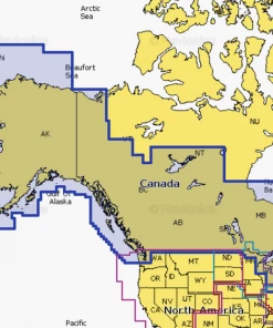
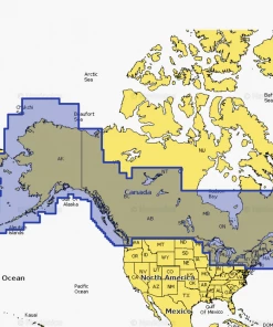
Detailed coverage of the Atlantic and Pacific coasts, inland lakes and waterways of Alaska and Canada (except YT and NU). Coverage includes the Aleutian Islands, Vancouver Island, Puget Sound, the St Lawrence River, the Maritime Provinces and the Grand Banks.
Product Description:
- One Year subscription included
- Not intending for use with Garmin devices
- For Chartplotter compatibility information, please refer to this guide.
| Navionics+ | |
|---|---|
| Coastal Content | • |
| Inland Content | 42,000+lakes |
| Detailed Nautical Charts | • |
| SonarChartTM HD Bathymetry | • |
| Daily Updates1 | • |
| Dock-to-dock Route Guidance 1,2 | • |
| Plotter Sync1 | • |
| Community Edits | • |
| Advanced Map Options1 | • |
| SonarChartTM Live Mapping3 | • |
| High-resolution Relief Shading1 | n/a |
| Satellite Imagery with SonarChartTM Shading Overlay1 | n/a |
| Sonar Imagery1 | n/a |
| Aerial Photography | n/a |
| 3D View | n/a |
Be the first to review “MARINE ELECTRONICS Navionics Navionics+ Map Card”
Related products
Sale!

MARINE ELECTRONICS
Original price was: $431.00.$91.99Current price is: $91.99.
Sale!

MARINE ELECTRONICS
Original price was: $76.21.$58.68Current price is: $58.68.
Sale!
BOATING ACCESSORIES
Original price was: $484.00.$94.99Current price is: $94.99.
Sale!

MARINE ELECTRONICS
Original price was: $247.71.$95.99Current price is: $95.99.
Sale!
MARINE ELECTRONICS
Original price was: $41.15.$32.92Current price is: $32.92.
Sale!
MARINE ELECTRONICS
Original price was: $247.71.$98.99Current price is: $98.99.
Sale!

BOATING ACCESSORIES
Original price was: $365.85.$95.99Current price is: $95.99.
Sale!
MARINE ELECTRONICS
Original price was: $102.89.$86.43Current price is: $86.43.
Reviews
There are no reviews yet.