


Sale!


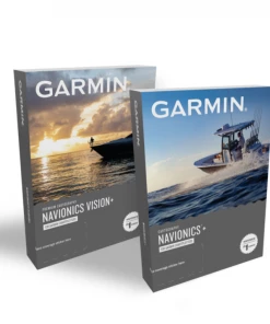

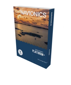
Garmin Navionics+ Map Card MARINE ELECTRONICS
Original price was: $144.81.$91.99Current price is: $91.99.
- Multiple payment options for secure shopping with SSL
- Service that stands out, online and always timely.
- Quality You Can Trust
- Efficient and effective customer service, online.

Garmin Navionics+ Map Card
PLOT YOUR PARADISE — with the best, most up-to-date Garmin Navionics+™ marine cartography on your compatible Garmin chartplotter. For offshore or inland waters, get detail-rich integrated mapping, shaded depth contours, advanced Auto Guidance+™ technology1 and access to daily updates via the ActiveCaptain app.
Product Description:
- Integrated Garmin and Navionics content, with an updated color palette and Navionics style appearance, provides exceptional coverage, clarity and detail
- Easy access to daily chart updates is available via the ActiveCaptain app
- Built-in Auto Guidance+™ technology uses your desired depth and overhead clearance, along with chart data and frequently traveled routes, to calculate a suggested path to follow from dock to dock
- NOAA raster cartography is available as a free downloadable feature via the ActiveCaptain app
- Depth range shading lets you select up to 10 color-shaded options and view your target depths at a glance
- For improved fishing and navigation, up to 1’ contours provide a more detailed depiction of bottom structure
- To aid in navigation, the shallow water shading feature highlights depths up to a user-defined level
- ActiveCaptain community content provides valuable POIs, recommendations and advice from boaters with firsthand experience of the local environment
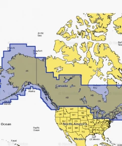
- Worldwide coverage available
- Available on microSD™ cards or via download (each region sold separately); cartography updates are available via annual renewable subscription (the first year of updates is included)
| Garmin Navionics+ | Garmin Navionics Vision+ | |
| Coastal Content | • | • |
| Inland Content | 42,000+ lakes | 42,000+ lakes |
| Detailed Nautical Charts | • | • |
| Up To 1′ Contours | • | • |
| Daily Updates1 | Via ActiveCaptain App | Via ActiveCaptain App |
| Auto Guidance+ Technology2 | • | • |
| ActiveCaptain® App Support | • | • |
| ActiveCaptain Community | • | • |
| Depth Range Shading | • | • |
| Shallow Water Shading | • | • |
| Dynamic Lake Level | • | |
| Raster Cartography1,3 | Via ActiveCaptain App | Via ActiveCaptain App |
| High-Resolution Relief Shading1 | Via ActiveCaptain App | |
| High-Resolution Satellite Imagery1 | Via ActiveCaptain App | |
| Sonar Imagery1 | Via ActiveCaptain App | |
| Aerial Photography | • | |
| Side Scan Images | • | • |
| 3D Fisheye View | • | |
| 3D Marinereye View | • |
Be the first to review “Garmin Navionics+ Map Card MARINE ELECTRONICS”
Related products
Sale!
MARINE ELECTRONICS
Original price was: $108.99.$80.65Current price is: $80.65.
Sale!
BOATING ACCESSORIES
Original price was: $484.00.$94.99Current price is: $94.99.
Sale!

MARINE ELECTRONICS
Original price was: $76.21.$58.68Current price is: $58.68.
Sale!

BOATING ACCESSORIES
Original price was: $51.82.$42.49Current price is: $42.49.
Sale!
MARINE ELECTRONICS
Original price was: $41.15.$32.92Current price is: $32.92.
Sale!
MARINE ELECTRONICS
Original price was: $247.71.$98.99Current price is: $98.99.
Sale!
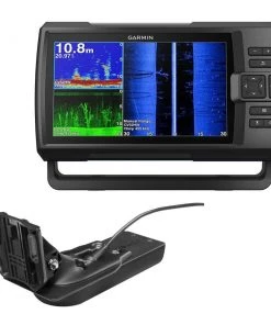
MARINE ELECTRONICS
MARINE ELECTRONICS Garmin STRIKER Vivid 9sv With GT52HW-TM Transducer
Original price was: $540.00.$94.99Current price is: $94.99.
Sale!
BOATING ACCESSORIES
Original price was: $217.22.$91.99Current price is: $91.99.
Reviews
There are no reviews yet.